

Quiz: Flight Planning
|
Getting your Trinity Audio player ready...
|
A successful IFR flight begins well before the aircraft leaves the ground. Pilots must evaluate weather trends, verify equipment and database currency, select appropriate altitudes, and build a complete operational picture prior to departure.
This month’s quiz features questions drawn from potential FAA instrument rating knowledge test questions, all available in Sporty’s Instrument Rating Course. Test your knowledge of cross-country flight planning, enroute altitude limits, and coastal weather hazards.
As a first step in planning an instrument cross-country in actual IFR conditions, you should:

Correct!
Wrong!
You are planning an IFR flight in an airplane with a panel-mounted GPS receiver. What verification must be accomplished before this flight takes place?

Correct!
Wrong!
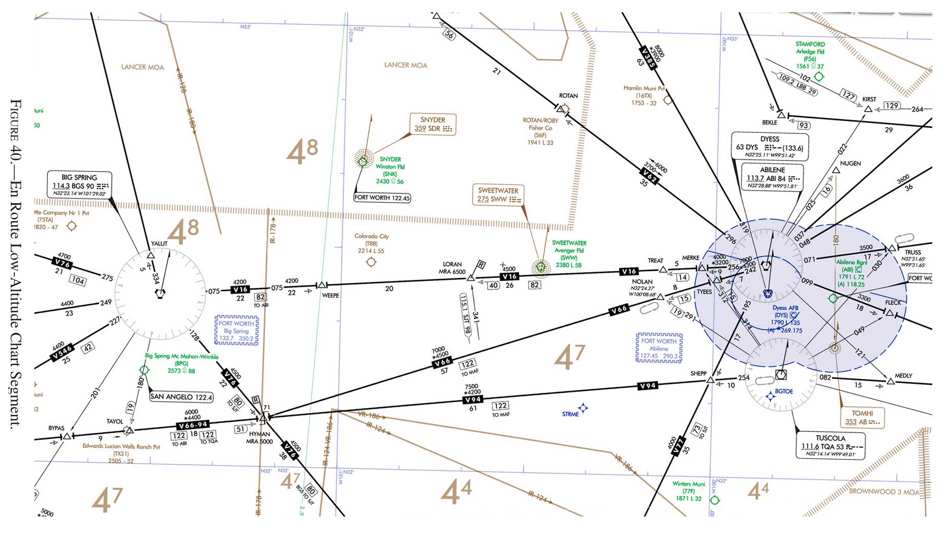
(Refer to the figure) For planning purposes, what is the highest useable altitude for an IFR flight on V16 from BGS VORTAC to ABI VORTAC?
Correct!
Wrong!
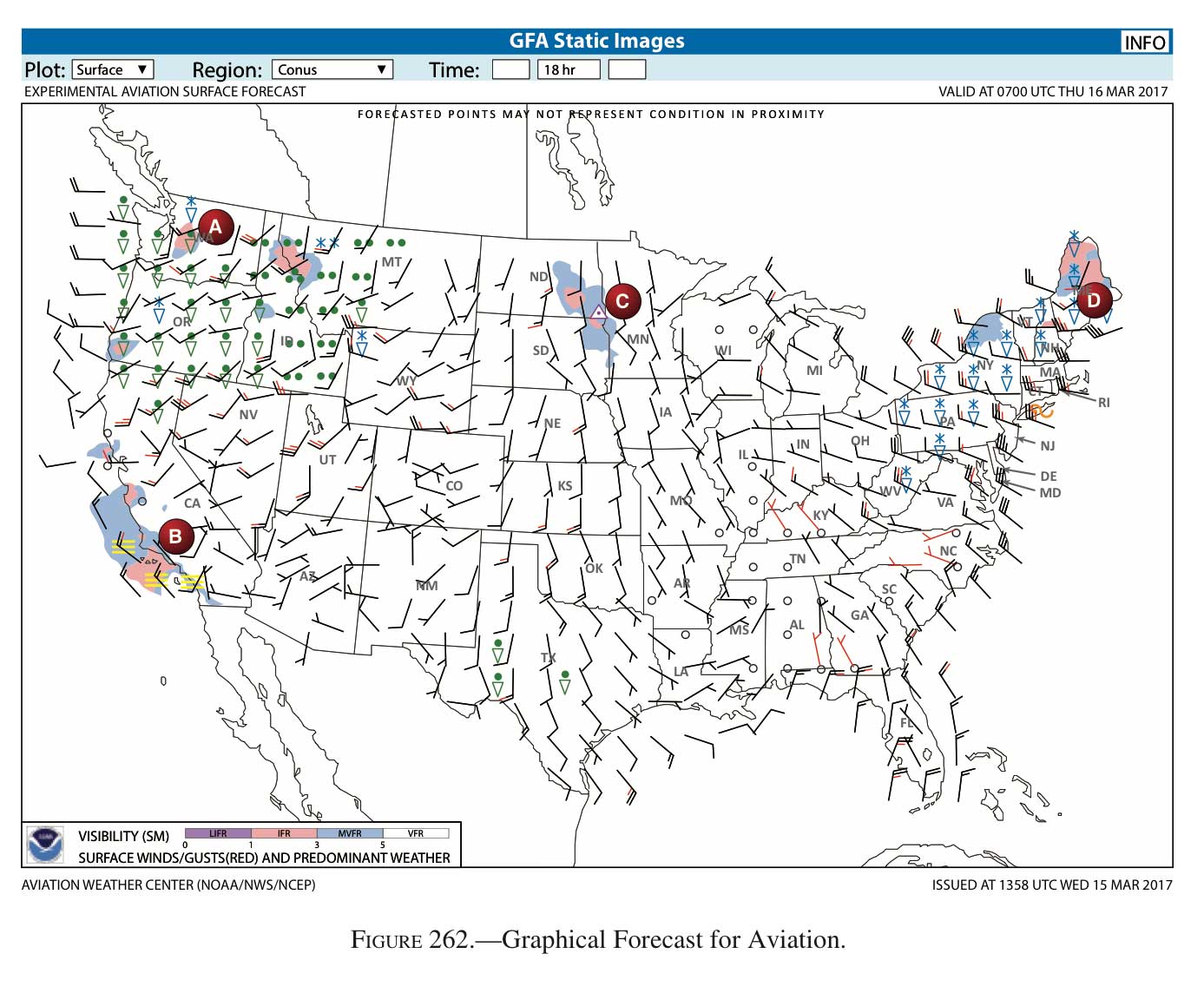
(Refer to the Figure) You are planning a flight to an area near the coast of Southern California (area B). What weather conditions should you be concerned about?
Correct!
Wrong!
How can a pilot determine if a Global Positioning System (GPS) installed in an aircraft is approved for IFR enroute and IFR approaches?

Correct!
Wrong!

Flight Planning
You got out of 5 right!


The IFR Focus Team is made up of experienced flight instructors, professional pilots, and editors dedicated to helping instrument pilots sharpen their skills. Drawing on decades of real-world flying and teaching experience, the team curates practical tips, training resources, and scenario-based content to make IFR flying safer and more enjoyable.
Latest posts by IFR Focus Team (see all)
- Quiz: Flight Planning - November 20, 2026
- Video Tip: Understanding NOTAMs - November 13, 2026
- Quiz: Flying Skills and Fundamentals - October 30, 2026

Leave a Reply
Want to join the discussion?Feel free to contribute!