Quiz: IFR Cross-Country Planning

Getting your Trinity Audio player ready...
1 min read

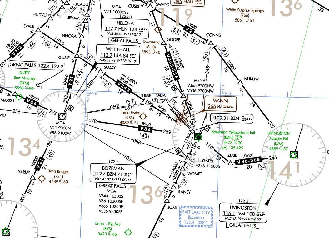
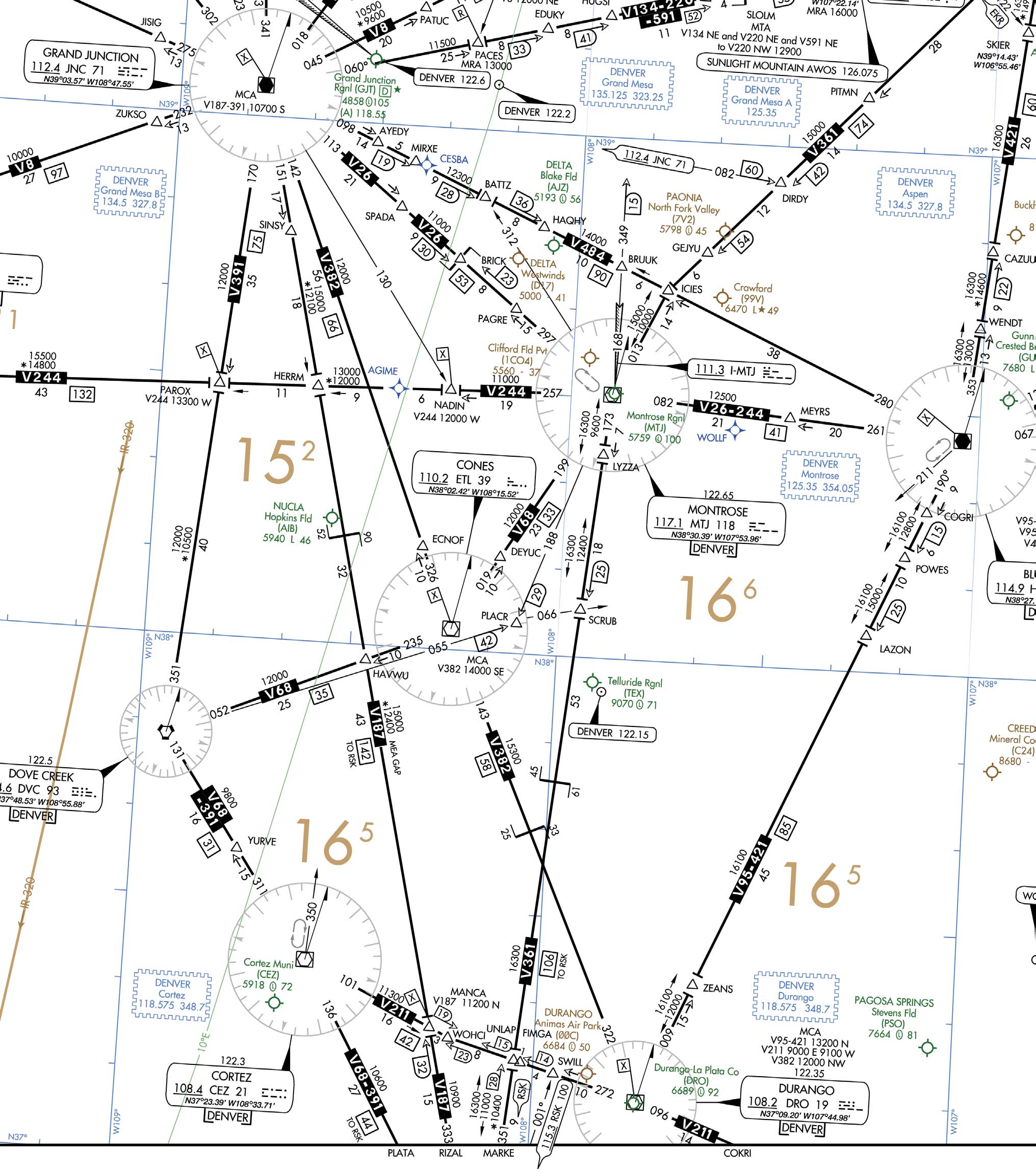
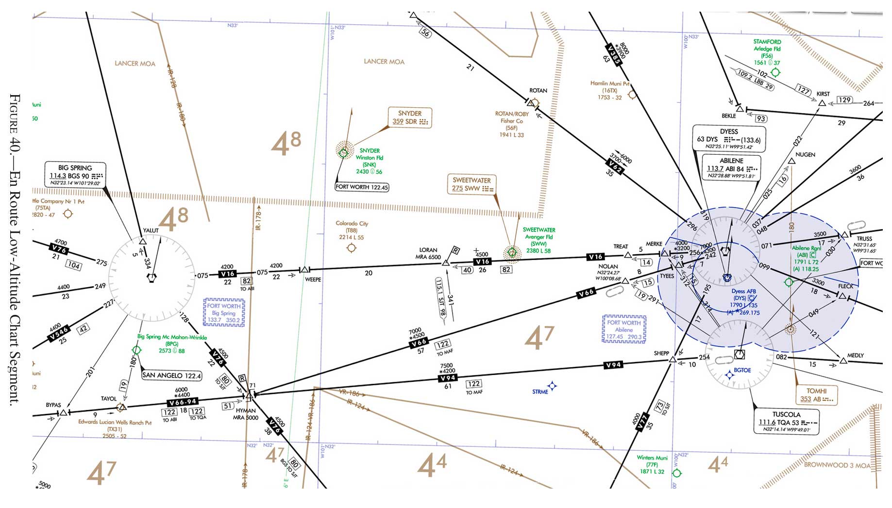
IFR cross-country planning pulls together a lot of moving parts—altitudes, airways, terrain, weather requirements, and a careful reading of the regulations and charts that tie it all together. Whether you’re planning a short hop under a busy terminal area or a longer enroute segment over unfamiliar terrain, the decisions you make before departure often matter as much as anything you do in the air.

This quiz focuses on the kinds of scenarios pilots regularly study in FAA knowledge training and testing environments, where chart interpretation and regulatory knowledge intersect. You’ll see questions on minimum altitudes, route structure, alternate requirements, and enroute planning details that sometimes hide in plain sight. Some are straightforward, others require a closer look at how the rules apply in context. See how well you can translate the charts and regulations into sound IFR planning decisions.


(Refer to the figure.) When eastbound on V86 between Whitehall and Livingston, the minimum altitude that you should cross BZN is
Correct! Wrong!
You are flying an off-airways IFR flight over nonmountainous terrain. What is the rule regarding altitude and course to be maintained if no applicable minimum is prescribed?
Correct! Wrong!
(Refer to the figure) What is the MOCA between the HERRM intersection and the MANCA intersection on V187?
Correct! Wrong!
When an alternate airport is required, what are the weather minimums that must be forecast at the ETA for an alternate airport that has a precision approach procedure?
Correct! Wrong!
(Refer to the figure) For planning purposes, what is the highest useable altitude for an IFR flight on V16 from BGS VORTAC to ABI VORTAC?
Correct! Wrong!

Share the quiz to show your results !


Just tell us who you are to view your results !

Cross-Country Planning You got out of 5 right!

instrument rating course

IFR Focus Team
Latest posts by IFR Focus Team (see all)
0 replies

Leave a Reply

Want to join the discussion?
Feel free to contribute!

Leave a Reply

Your email address will not be published. Required fields are marked *