Half Sized Blog Element (Single Author Style)
Half Sized Blog Element (Multi Author Style)
Practical IFR: Mix and Match
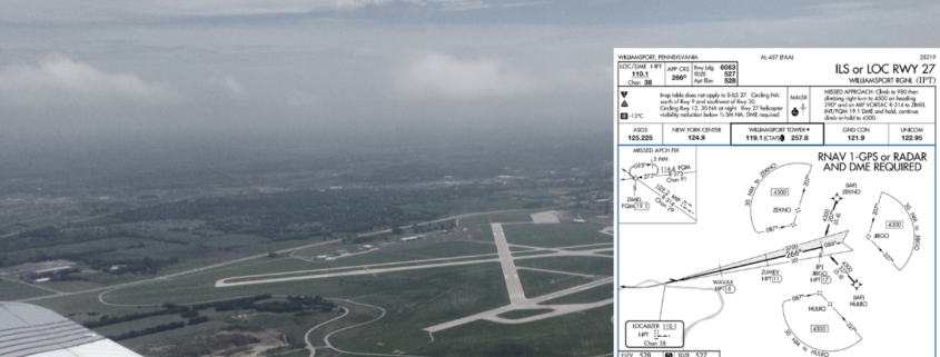
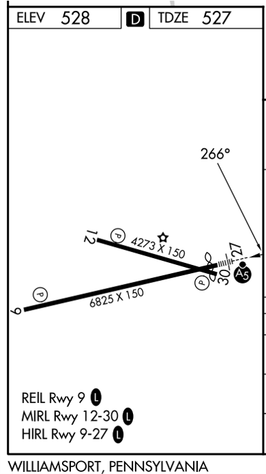
As an aviation writer, I’m always on the prowl for interesting approach charts (so if you have a favorite, drop me a line). One that recently appeared in my email was the ILS or LOC Rwy 27 at Williamsport, Pennsylvania (KIPT). The striking curiosity was plan view note, “RNAV 1-GPS or RADAR AND DME REQUIRED.” The investigation yielded a longer explanation than I expected. Too bad I don’t get paid by the word.

Quiz: IFR Cross-Country Planning
IFR cross-country planning pulls together a lot of moving parts—altitudes, airways, terrain, weather requirements, and a careful reading of the regulations and charts that tie it all together. Whether you’re planning a short hop under a busy terminal area or a longer enroute segment over unfamiliar terrain, the decisions you make before departure often matter as much as anything you do in the air.
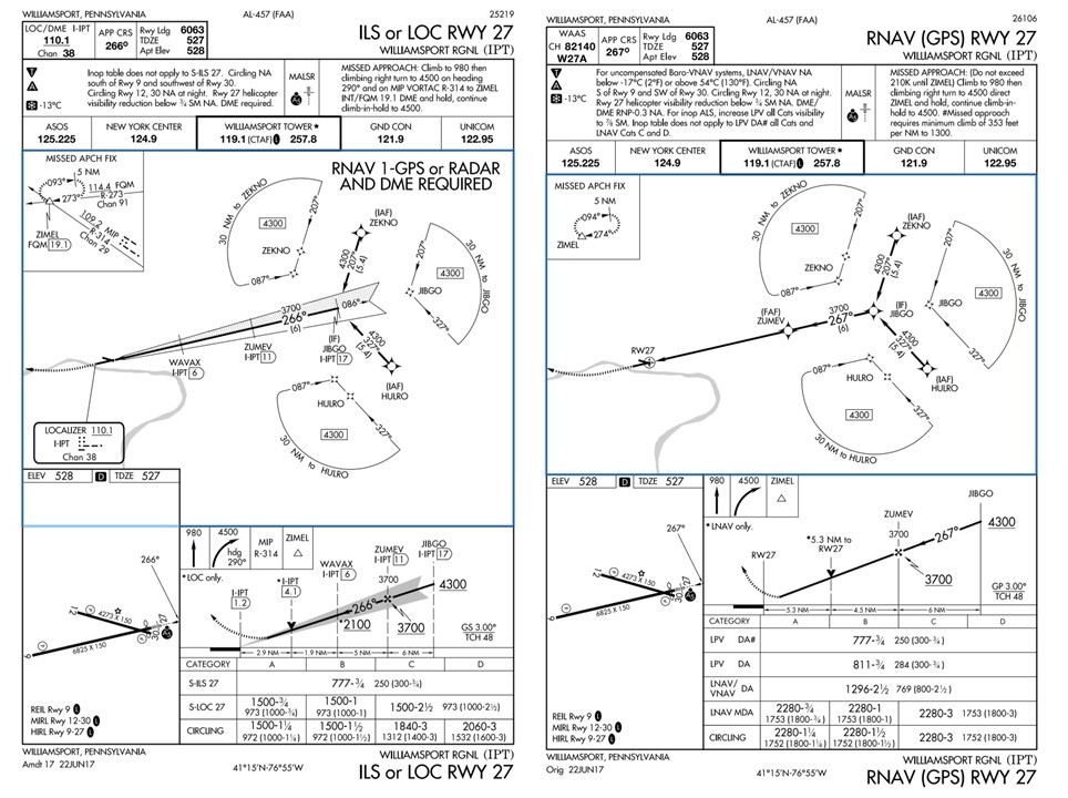
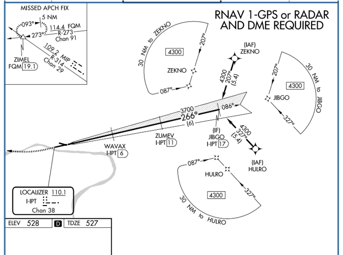 The ILS or Loc Rwy 27 at KIPT is hybrid of two approaches. It’s a conventional ILS with the terminal arrival area (TAA) from the RNAV (GPS) Rwy 27 approach grafted on. To transition from enroute to the localizer: Enter one of the three sectors at or above 4300 feet, fly to the initial approach fix for that sector (ZEKNO, JIBGO, or HULRO), intercept the localizer and cross JIBGO, and descend to cross the final approach fix of ZUMEY at or above 3700 feet. There’s no course reversal charted because there’s no direction from which a procedure turn is required, or for that matter, allowed.
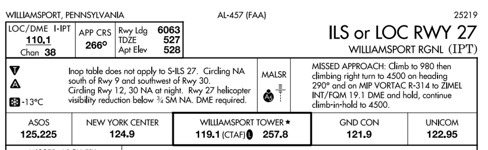


Practical IFR: Mix and Match
/by Jeff Van WestAs an aviation writer, I’m always on the prowl for interesting approach charts (so if you have a favorite, drop me a line). One that recently appeared in my email was the ILS or LOC Rwy 27 at Williamsport, Pennsylvania (KIPT). The striking curiosity was plan view note, “RNAV 1-GPS or RADAR AND DME REQUIRED.” The investigation yielded a longer explanation than I expected. Too bad I don’t get paid by the word.
Quiz: IFR Cross-Country Planning
/by IFR Focus TeamIFR cross-country planning pulls together a lot of moving parts—altitudes, airways, terrain, weather requirements, and a careful reading of the regulations and charts that tie it all together. Whether you’re planning a short hop under a busy terminal area or a longer enroute segment over unfamiliar terrain, the decisions you make before departure often matter as much as anything you do in the air.